Ecuador, le foto del vulcano Cotopaxi in azione. Nuvola di gas alta quasi 2 km. FOTO

Mondo
©Ansa

Seconda montagna più alta dell’Ecuador dopo il Chimborazo e uno dei vulcani più attivi del Sudamerica, nei giorni scorsi ha emesso una colonna di gas e ceneri straordinariamente alta

ascolta articolo

In Ecuador il vulcano Cotopaxi ha emesso un pennacchio vulcanico di cenere e gas  che durante il fine settimana ha raggiunto un'altezza di 1,8 chilometri di altezza (1,1 miglia) sopra il cratere. La cenere del vulcano, fa sapere l'Istituto geofisico ecuadoriano, è caduta a sud della capitale, Quito, e nelle valli circostanti. Il vulcano, uno dei più attivi del Sudamerica, emette vapori e gas da ottobre, ma la colonna che si è alzata nei giorni scorsi è stata straordinariamente alta. I sismologi hanno affermato che era costituita principalmente da gas e conteneva solo piccole quantità di cenere.
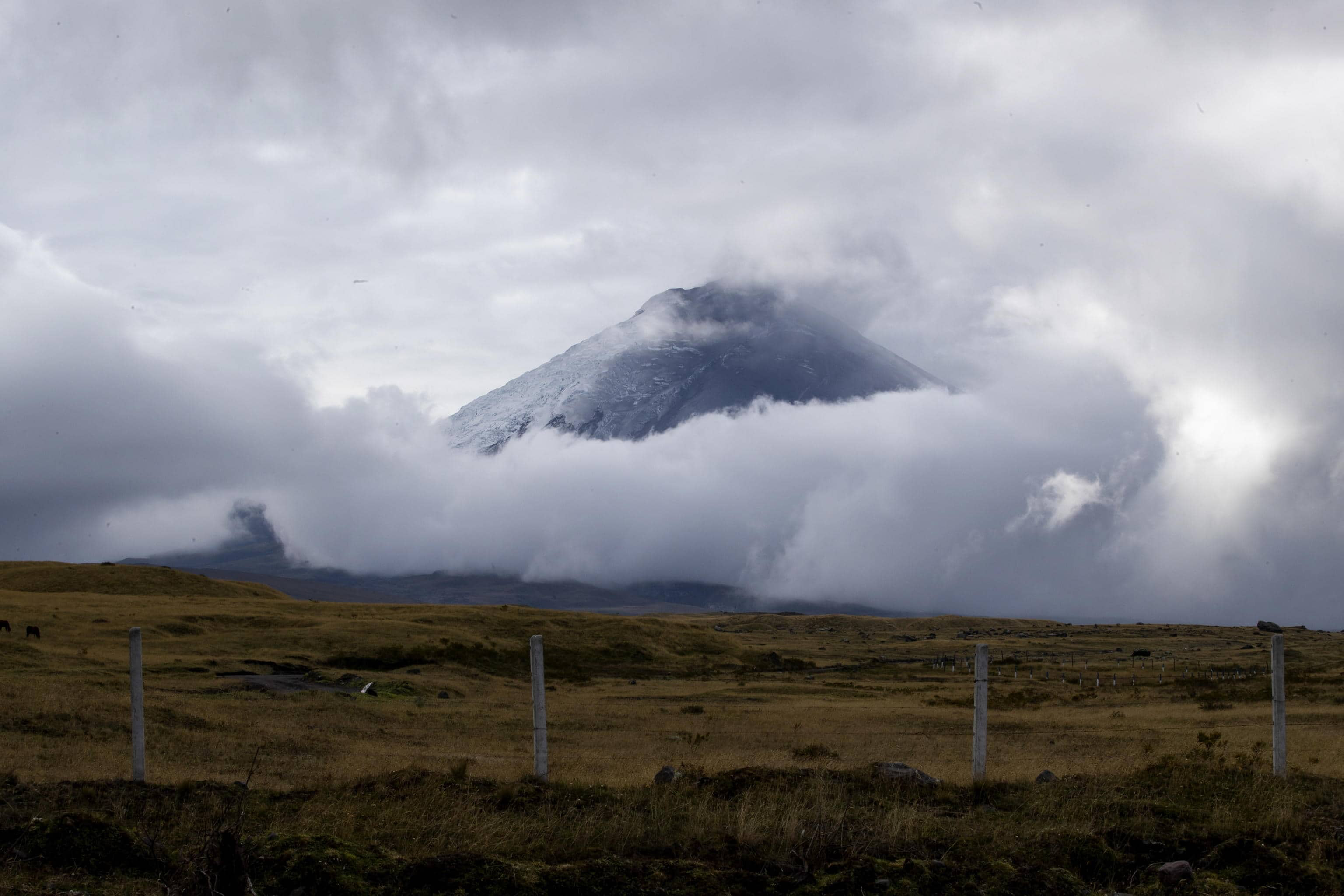
epa10330744 The Cotopaxi volcano, in the cantons of Quito and Mejia, in the province of Pichincha, Ecuador, 26 November 2022. A slight ash fall from the Cotopaxi volcano was recorded this 26 November in the Quito and Mejía cantons, in the Ecuadorian province of Pichincha, reported the National Risk and Emergency Management Service of Ecuador. In his social networks, he explained that the fall of volcanic dust was reported in the parishes of Quitumbe, Guamaní, La Merced, Amaguaña, as well as in San Juan, the Historic Center, La Mena, Chillogallo and La Ecuatoriana (south and center of Quito).  EPA/Jose Jacome
ECUADOR VOLCANO - ©Ansa


Il Cotopaxi ha eruttato dozzine di volte: memorabile quella dell'agosto 2015 quando fuoriuscirono dal cratere grandi quantità di cenere dopo un periodo di relativa calma durato 70 anni (venne dichiarato lo stato di emergenza).
Una delle eruzioni più significative avvenne invece nel 1877 quando le colate di fango vulcanico viaggiarono fino a 100 chilometri (60 miglia) dal cratere e distrussero la città di Latacunga. La prima eruzione del Cotopaxi risale invece al 1534 e fu segnalata dai conquistadores spagnoli.

eruzione-vulcano-tonga-satellite-ansa

approfondimento

L'eruzione a Tonga è stata la più forte mai registrata
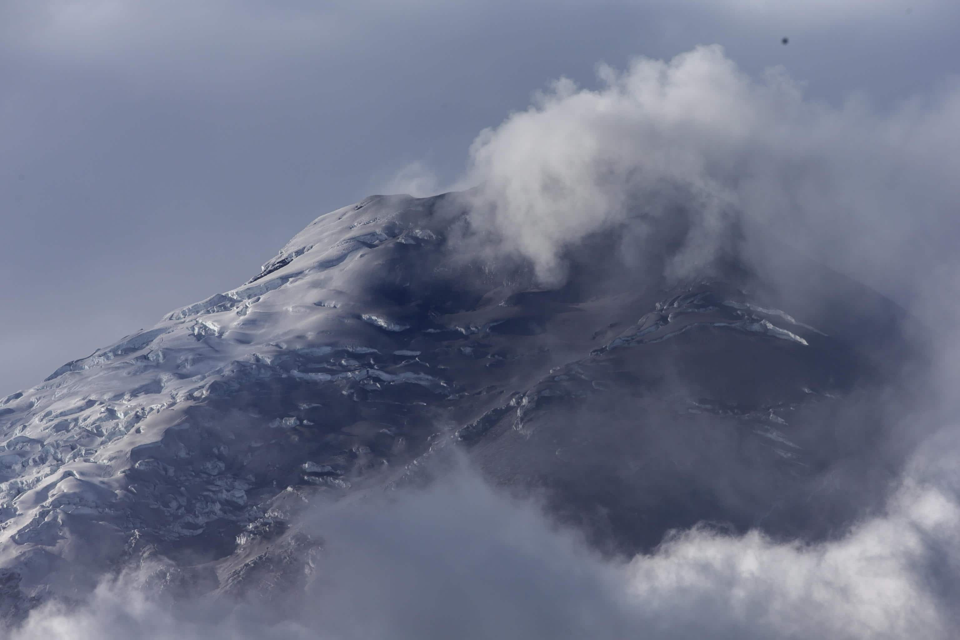
epa10330743 The Cotopaxi volcano, in the cantons of Quito and Mejia, in the province of Pichincha, Ecuador, 26 November 2022. A slight ash fall from the Cotopaxi volcano was recorded this 26 November in the Quito and Mejía cantons, in the Ecuadorian province of Pichincha, reported the National Risk and Emergency Management Service of Ecuador. In his social networks, he explained that the fall of volcanic dust was reported in the parishes of Quitumbe, Guamaní, La Merced, Amaguaña, as well as in San Juan, the Historic Center, La Mena, Chillogallo and La Ecuatoriana (south and center of Quito).  EPA/Jose Jacome
ECUADOR VOLCANO - ©Ansa

Situata a 50 chilometri sud-est della capitale Quito e a 33 chilometri a nord-est da Latacunga, con un'altitudine di 5.872 metri Cotopaxi è la seconda montagna più alta dell'Ecuador dopo il Chimborazo (6.310 m) e il terzo vulcano più alto del mondo, dopo il Sabancaya in Perù e l'Ojos del Salado in Cile.

Vulcano Hawaii

approfondimento

Hawaii, il vulcano Mauna Loa erutta dopo 38 anni. VIDEO
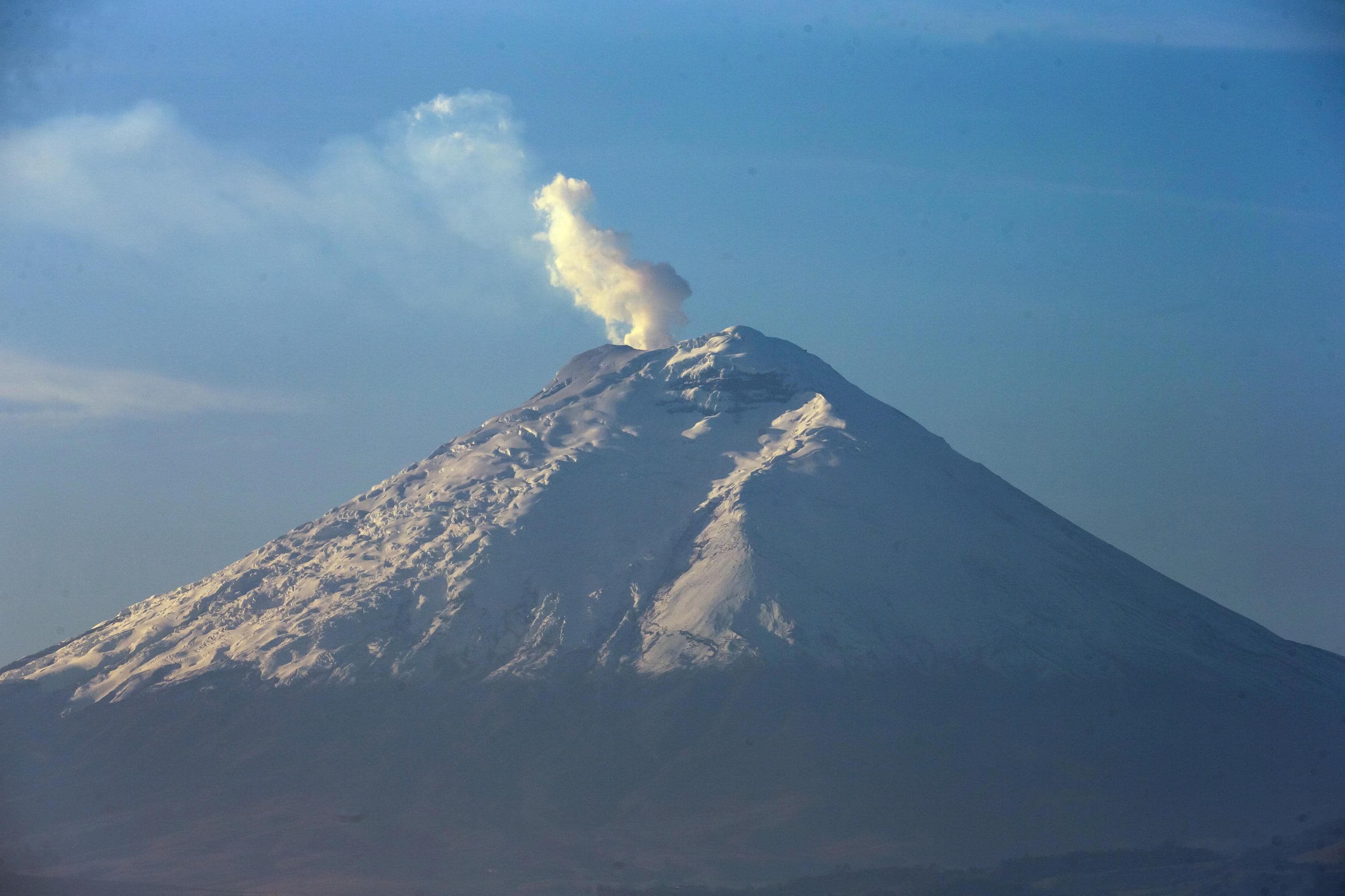
epa10324867 The Cotopaxi volcano with a steam fumarole as seen from Quito, Ecuador, 24 November 2022. In a report the Geophysical Institute (IG), recalled that on October 21 a low-frequency tremor signal associated with an emission of gasses and ash was recorded, which produced a moderate fall of this material on the northern flank of the volcano. Since then, the emission of gasses has been almost continuous and clearly visible, with columns that have reached up to two kilometers above the level of the crater.  EPA/JOSE JACOME
ECUADOR VOLCANO

Mondo: I più letti